Chilly spring storm will blow polar air mass into Bay Area
SAN FRANCISCO (KRON) — A polar air mass is forecast to blow into the San Francisco Bay Area on Thursday and possibly dust local mountain peaks with snow.
Tuesday’s sunny and warm weather will dramatically change when a chilly spring storm arrives later in the week. “Get ready for the rollercoaster ride. We are really cooling down Thursday,” KRON4 meteorologist Kyla Grogan said.
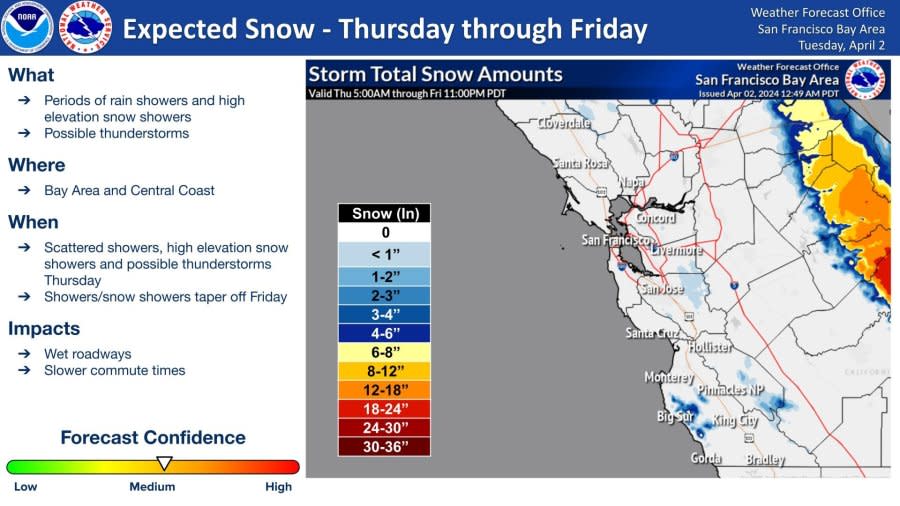
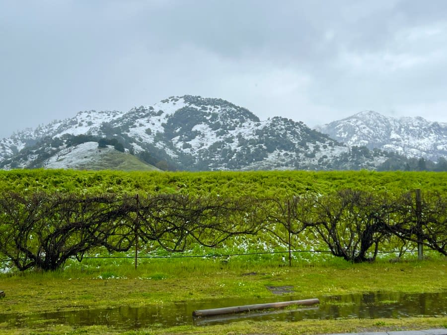
The Bay Area’s highest altitudes can expect a “dusting” of snow, the National Weather Service Bay Area said.
PHOTOS: 2023 storm dusts Mount Diablo, Tamalpais, Hamilton with snow
Down on the Central Coast, more than three inches of snow is forecast in the Santa Lucia Range in Monterey County, according to the NWS.
Temperatures will begin to drop when cold onshore winds strengthen late Wednesday. “Clouds will be on the increase by Wednesday as a deep upper level trough begins to approach the region,” the NWS wrote.
The cold front will move from north to south. “The temperature on Thursday will be drastically colder than it has been in the preceding days, with many inland areas dropping into the 30s. In fact, this polar air mass may bring near record low temperatures,” a NWS forecaster wrote.
Scattered showers and thunderstorms will sprinkle rain over the Bay Area on Thursday and Friday.
“The total rainfall from this system is still looking light to moderate at 0.10-0.50 (inches) for most populated areas. However, with the very cold air aloft, there is a chance for instability to trigger a few thunderstorms with locally higher rain totals and some hail. The cold air will bring some high elevation snow,” a NWS forecaster wrote.
Clear skies are forecast for this weekend.
For the latest news, weather, sports, and streaming video, head to KRON4.

