Last flood of this magnitude was in 2019, but more heavy rain is on the way, NWS predicts
Southeastern South Dakota should prepare to see another round of heavy rain Friday night and into Saturday, with some areas predicted to see another 2 to 5 inches of rain on top of what’s already fallen.
The last time something of this magnitude was seen, with multi-hour flash flood warnings, was in 2019 when there were multiple rounds of heavy rain and the ground was saturated and “couldn’t handle it anymore,” National Weather Service director Todd Heitkamp said.
Heitkamp said there are too many flash flood warnings to name at this time, and that anyone living in an area not in a flood warning, should consider themselves in a flood watch as the heaviest rain will come after 5 p.m. Friday.
A flood watch is in effect through 7 a.m. Saturday for all of southeastern South Dakota, and a flood warning is currently in effect for the following areas until 7:30 a.m. Saturday, according to NWS:
Portions of northwest Iowa, including the following counties, Clay, Dickinson, Lyon, O`Brien, Osceola and Sioux
Southwest Minnesota, including the following county, Nobles
And southeast South Dakota, including the following counties, Lincoln, Turner and Union
"Additional rainfall amounts of 1 to 4 inches are possible in the warned area over the next 24 hours," the flood warning states.
Locations that will experience flooding include: Sioux Falls, Sioux Center, Sheldon, Canton, Sibley, Rock Rapids, Beresford, Parker, Harrisburg, Tea, Rock Valley, Hull, Lennox, Sanborn, George, Centerville, Worthing, Larchwood, Inwood and Viborg.
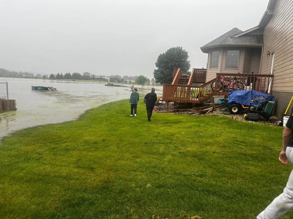
The most impacted areas will be south of Interstate 90 and east of Highway 81 in South Dakota, Heitkamp said.
“Whatever rain we get, no matter what amounts, it’s going to add to the problems that already exist and make matters worse,” Heitkamp said. “The main thing that people need to remember is just to stay abreast of the weather conditions and be prepared to take action if your area begins to flood.”
Heitkamp said if you don’t have to travel, especially in areas like Lincoln County and others with a lot of water, don’t travel.
Zooming into Sioux Falls, 3 to 5 inches of rain fell across the city which has lead to ponding on roadways and even some road closures.
Canton, SD has reported the highest rainfall so far with 7.75 inches! pic.twitter.com/5yHO3kJw68— NWS Sioux Falls (@NWSSiouxFalls) June 21, 2024
The NWS stated 3 to 5 inches of rain fell across Sioux Falls overnight between Thursday and Friday, which has lead to ponding on roadways and even some road closures. The city broke its daily rainfall record of 3.35 inches in 2018 to 3.50 inches Friday, NWS stated.
A flood warning has been issued for the Big Sioux River at Brandon affecting Lincoln, Minnehaha and Lyon counties, but it's unclear when the warning is expected to expire.
In Canton, where the flood warning lasted eight hours from 1 a.m. to 9:15 a.m., the city experienced the highest rainfall so far for the area, with 7.75 inches, NWS states. Both Beaver Creek and the Big Sioux River above Canton have reached major flood levels, according to the NWS Regional River Status map.
This article originally appeared on Sioux Falls Argus Leader: South Dakota floods: NWS director urges no travel in Lincoln County

