Heat wave continues, relief coming on Sunday
Columbus and Central Ohio Weather
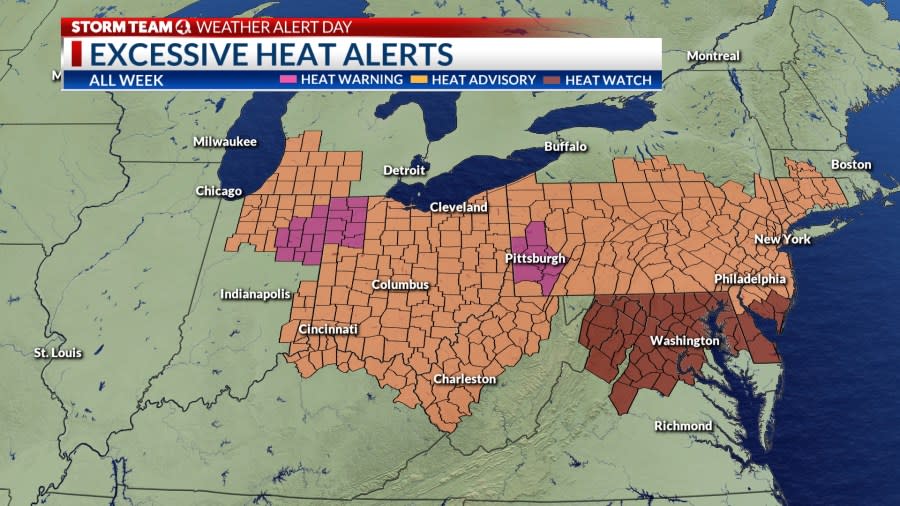
A large dome of heat covers the eastern half of the country. At the surface, high pressure is anchored over the Mid-Atlantic states, continuing a light southeasterly flow of hot, humid air.
Sunshine and dry weather will result in slightly warmer readings in the mid-90s, with a subtle drop in humidity. Regardless, plenty of heat and humidity will make it uncomfortable, and it’s important to stay hydrated and limit your time outdoors during the afternoon hours.
An isolated shower or storm is possible over the northern part of the state near a stalled frontal boundary.
After another hot, humid day on Saturday, a cold front will cross Ohio Sunday, kicking off a few showers and storms and bringing a little cooler and less humid weather to start next week.
High pressure will drift across the Great Lakes on Monday. However, a return flow from the south will begin to warm things up again on Tuesday into the low 90s. The next chance for showers and storms comes with a cold front Wednesday.
Forecast
Friday: Partly cloudy, hot, sticky. High 95
Tonight: Mostly clear, warm. Low 74
Saturday: Mostly sunny, hot. High 96
Sunday: Mostly cloudy, scattered showers, storms. High 88 (76)
Monday: Sunny, less humid. High 86 (67)
Tuesday: Sunny, warmer. High 92 (65)
Wednesday: Mostly cloudy, few storms. High 89 (72)
Thursday: Sunny. High 82 (63)
Copyright 2024 Nexstar Media, Inc. All rights reserved. This material may not be published, broadcast, rewritten, or redistributed.
For the latest news, weather, sports, and streaming video, head to NBC4 WCMH-TV.

