Hot and breezy Saturday, chance for storms late
What We’re Tracking
Breezy Saturday
Storms possible late
Very hot early next week
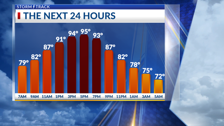
Winds have remained breezy through the night with a few clouds lingering. Temperatures haven’t given much relief as we start off in the upper 70s and lower 80s. Average highs for this time of year are in the middle to upper 80s.
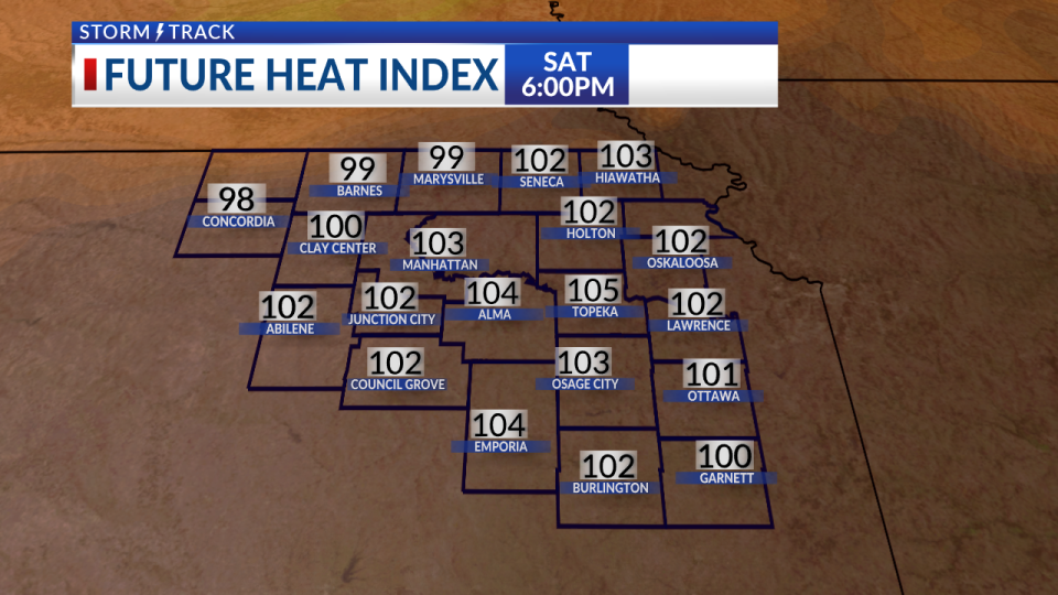
Saturday will be a breezy yet hot day. Winds will be from the south at 20 to 25 MPH and gusting near 35 MPH at times. Temperatures will jump into the upper 90s with heat index values feeling more like 100°-105°. This trend of warmer weather keeps going throughout the rest of the week.
We look to stay dry for most of the daytime with our next system moving through late tonight. Storms look to develop in our Southern counites with the potential for some stronger storms at times. The biggest threat would be strong wind gusts.
The heat continues inHighs climb back into the middle to upper 90s with heat index running into triple digits. Our next best chance for rain comes in late Saturday evening, wrapping up by Sunday morning. Hot weather then sticks around for a few more days into early next week.
KSNT Storm Track Meteorologist Gabriella Gomez
Copyright 2024 Nexstar Media, Inc. All rights reserved. This material may not be published, broadcast, rewritten, or redistributed.
For the latest news, weather, sports, and streaming video, head to KSNT 27 News.

