Juneteenth brings less humidity, drier weather ahead of the start of summer

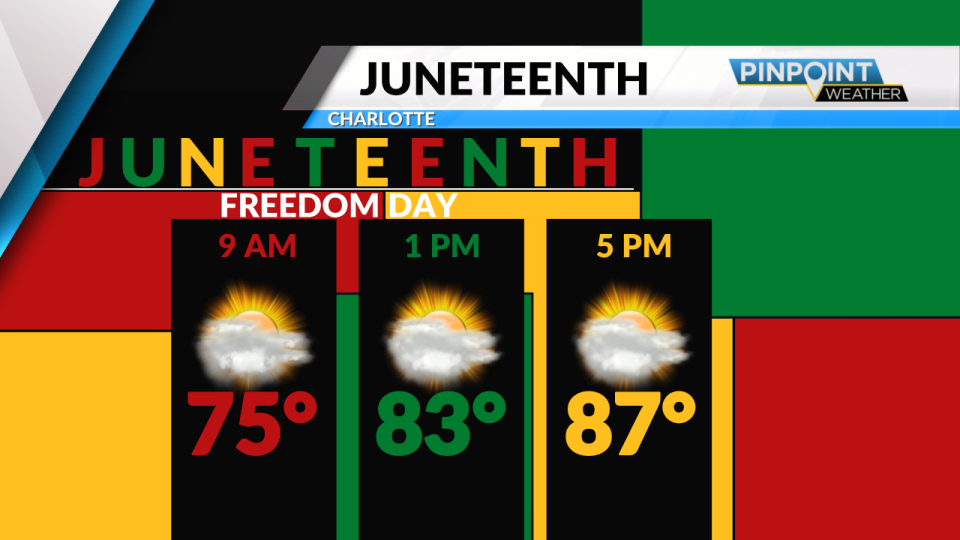
(PINPOINT WEATHER) — This is what we call “normal” heat early this week… and with a little less humidity for a few days!
The average afternoon high for mid-June is 88 degrees, and we’ll end up around that number through Thursday. The humidity level won’t be too steamy until the weekend. That’s when actual air temperatures get hotter, too! If you’ll be out and about over the weekend, plan to have enough water on hand and take it easy! Highs will be reaching the low and mid-90s starting Friday, with likely the hottest days being Saturday and Sunday.
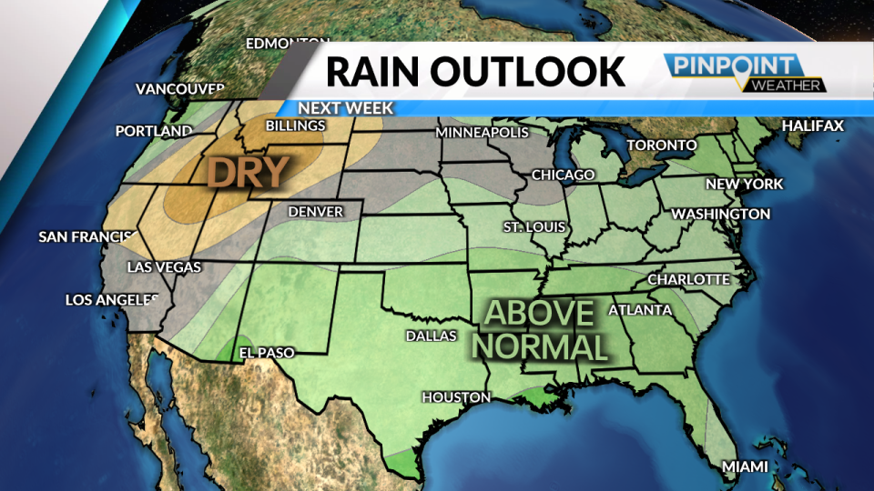
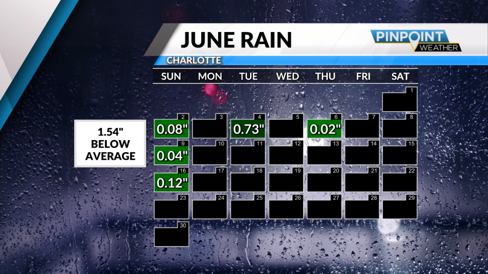

What about rain?? No surprise that it’s been an overall dry month so far. We’re running about 1.5 inches below average. But there are signs of a slightly wetter, more unsettled pattern next week as moisture increases and a front approaches. Shower and storm chances will be on the rise early next week.
Tonight: Fair sky. Low 66.
Wednesday: Sun & clouds. High 89.
Copyright 2024 Nexstar Media, Inc. All rights reserved. This material may not be published, broadcast, rewritten, or redistributed.
For the latest news, weather, sports, and streaming video, head to Queen City News.

