Minnesota weather: Very warm and humid, more late day storms Tuesday
MINNEAPOLIS (FOX 9) - Tuesday is going to be warm and humid with more storms coming later in the day.
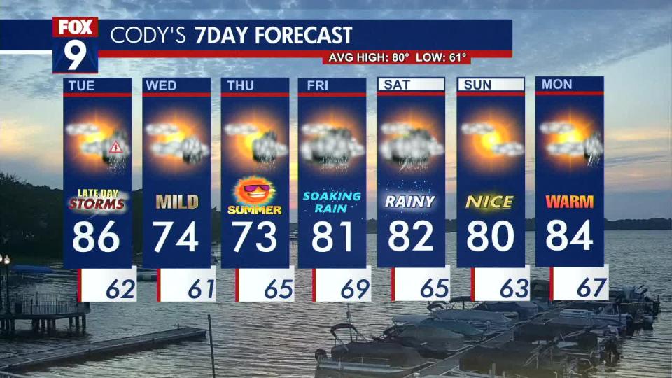
It will be steamy for much of the state with widespread 80s and a high of 86 degrees for the greater metro area. Things are staying quiet in the Twin Cities metro for the start of Tuesday before cloud coverage increases and a cold front works its way through, setting the stage for showers and storms to develop.
The storms should develop in central Minnesota and roll through in the afternoon and evening along the I-35 corridor before moving off to the east during the overnight hours.
A large portion of the state is under a Level 2 slight risk for severe weather, including the Twin Cities metro area. Meanwhile, very southeast Minnesota and some areas to the west are under a Level 1 marginal risk for Tuesday. The storms could bring the chance for heavy rain, large hail, damaging winds, and isolated tornadoes.
Clouds will linger into Wednesday morning as temperatures cool to a high of 74 degrees in the metro. Most of the state should stay dry during the day, but southern Minnesota may see a few showers. We could see our next chance of rain from Wednesday night into Thursday morning. Temperatures remain cooler with highs in the 70s for the first day of summer on Thursday.
Here’s a look at your seven-day forecast: