One week after wildfires ignited near Ruidoso, here's where efforts stand to put them out
The two fires burning in Lincoln and Otero counties and on Mescalero Apache Tribal lands had burned more than 24,000 acres, according to the New Mexico wildfire dashboard Saturday, June 22.
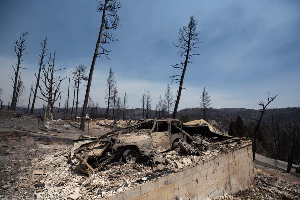
Among the damage created by the fire was the loss of over 1,400 structures in the region. The largest toll was the death of two people as a result of the fires.
Recent rains have helped slow the fire's progress, officials said, but have also caused chaos.
Wildfire still actively burning
The South Fork Fire grew by about 300 acres to 16,614 acres, while the Salt Fire grew by about 600 acres to 7,652 acres, according to fire size information the U.S. Forest Service released on Saturday.
Fire crews battling the blazes have built containment lines around 26% of the South Fork Fire and 7% of the Salt Fire.
Improvement in weather conditions also have brought relief. About a half inch of rain fell over the western edge of the South Fire Fork, where firefighters had seen it burn more intensely. About a half inch of rain fell over the Salt Fire too.
Fire officials expect "minimal fire activity or perimeter growth" with continued cloud cover, another chance of rain in the area, and humidity levels above 50%.
More: Amid winding mountain roads, a village pushes back its encroaching fire threat
So what is wildfire containment? “Wildfire containment is the status of a wildfire suppression action signifying that a control line has been completed around the fire, and any associated spot fires, which can reasonably be expected to stop the fires spread,” according to the Forest Service, U.S. Department of Agriculture.
Flood watch activated for Ruidoso
The National Weather Service issued a flood watch through 9 p.m. Saturday, June 22.
A forecast for the region shows a 40% chance of rain through Sunday morning.
More: Las Cruces Fire Department sends technical rescue team to Ruidoso
Because of the damage left by the wildfires, officials feared another round of flooding would strike. Earlier in the week, several swift water rescues were performed in the region after rain fell on the burn scar of the wildfires.
Will residents be able to go back to Ruidoso?
The evacuation orders for the village of Ruidoso and the city of Ruidoso Downs are still in effect.
Those evacuations extend to Fantasy Lane, Summit area, Botella Road, Snow Springs, Fence Canyon, Whitetail and Chihuahua Well.
The fires started Monday, June 17, and displaced about 8,000 people.
New Mexico fire map
View fires across New Mexico on the map below.
Having trouble viewing the map? Click here.
Aaron Bedoya of the El Paso Times contributed to this reporting.
This article originally appeared on Las Cruces Sun-News: Efforts to stop wildfires near Ruidoso continue a week later

