Cold front coming soon: What it means for temps

CLEVELAND (WJW) – The HEAT ADVISORY that has been in effect all week will finally be allowed to expire at 8 p.m. on Saturday.
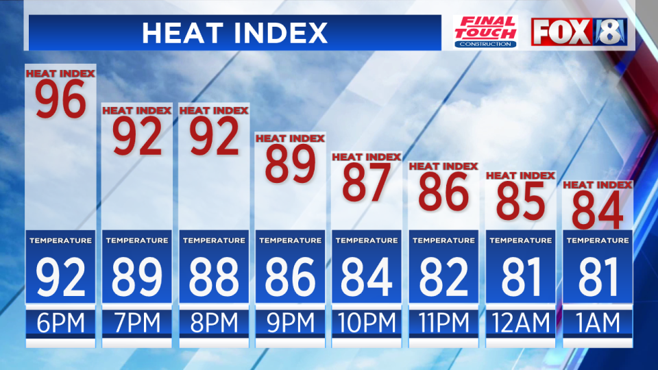
Even though the advisory will no longer be in effect, Saturday evening is still going to be very warm and humid. Heat index values will not drop below 90 degrees until 10 p.m.
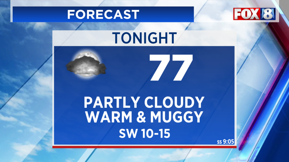
Saturday night will be partly cloudy and muggy. Overnight lows will be in the mid 70s.
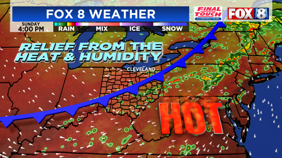
Finally, a cold front will bring an end to the heat wave on Sunday!
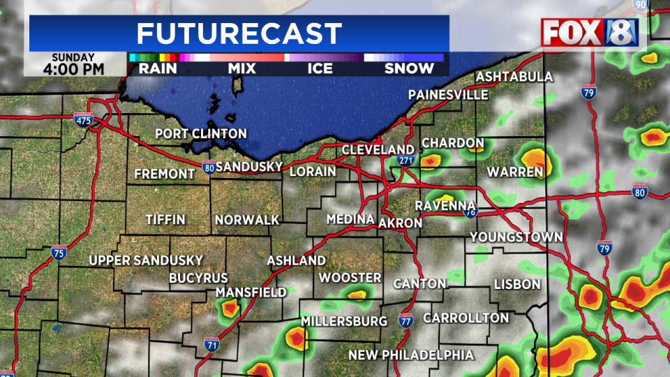
Scattered to numerous rain showers and storms will develop ahead of and along the front on Sunday. Some of the storms that develop Sunday afternoon/evening could be strong to severe and produce damaging wind gusts and locally heavy rainfall. The rain showers and storms will end from west to east across the area Sunday evening.
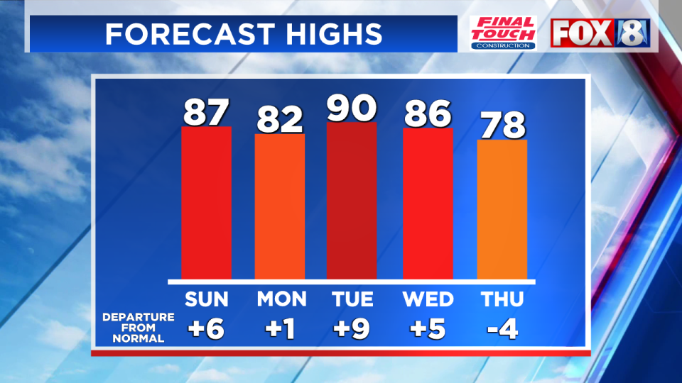
Sunday is still going to be very warm and humid. Highs will be in the mid to upper 80s.
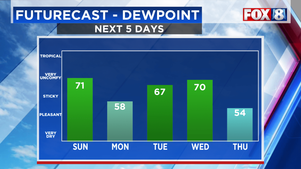
Sweet relief from the heat and humidity will arrive for the start of the workweek. Monday is going to be a much more comfortable day. Highs on Monday will be in the lower 80s.
This could end up being the warmest 7 day stretch since the summer of 1995. Here are the warmest 7 day stretches:
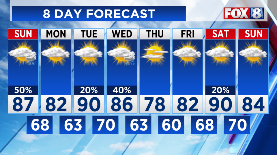
Here’s your latest 8-Day Forecast:
Copyright 2024 Nexstar Media, Inc. All rights reserved. This material may not be published, broadcast, rewritten, or redistributed.
For the latest news, weather, sports, and streaming video, head to Fox 8 Cleveland WJW.
