Clock running out on tropical development in southwest Gulf of Mexico


As a tropical rainstorm approached the coast of northeastern Mexico into Sunday night, time has now run out to spawn a tropical depression or storm just days after Alberto formed in the same region, AccuWeather meteorologists say. Regardless, the system will continue to spread heavy rain into northeastern Mexico on Monday.
"This feature in the southwestern Gulf that we are monitoring is a disturbance on the Central America gyre that has broken away and rolled west-northwestward this weekend," AccuWeather Lead Tropical Meteorologist Alex DaSilva said.
 |
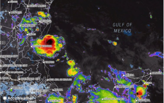
This image shows the tropical rainstorm over the Bay of Campeche on Sunday morning, June 23, 2024. (AccuWeather Enhanced RealVue™ Satellite) |
A gyre is a large, slowly spinning low-pressure area that often enhances showers and thunderstorms in its circle of influence. A gyre over Central America and southern Mexico is common this time of the year and can contribute to tropical storm or hurricane formation over the Caribbean Sea, Gulf of Mexico and the eastern Pacific Ocean.
AccuWeather began monitoring the system's potential in early June and issued an official track map for the center of the rainstorm late last week. The system will continue to push heavy rain inland with the risk of flooding, regardless of its official classification.
AccuWeather refers to it as a tropical rainstorm to raise awareness of the potential dangers. Only the National Hurricane Center can officially designate the system as a tropical depression or tropical storm.
 |
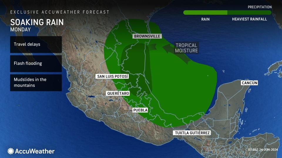
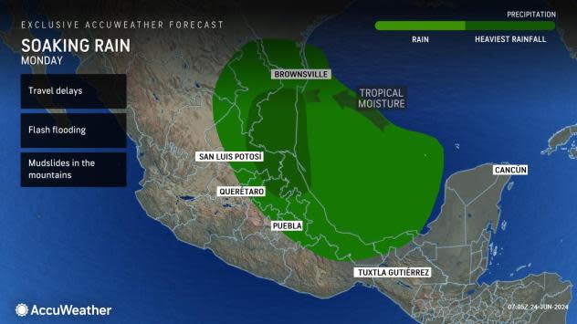
Widespread rainfall of 4-8 inches is anticipated in northeastern Mexico with some areas along the coast and inland on the east-facing slopes of the mountains picking up 8-12 inches. Localized amounts may be even higher. Since some of these areas were hit with similar rainfall from Alberto just a few days earlier, the flash flood and mudslide risk is significantly higher.
In the wake of the system along the northeast Mexico coast, the Atlantic may become quiet once again and remain so for many days. A lull in tropical activity is not uncommon during July.
"We will be on the lookout for another weak system that could try to develop in the southwestern Gulf of Mexico around the start of July," DaSilva said, "But, just like the system from Saturday to Sunday, it will not have much time to develop before being pushed into northeastern Mexico."
After the flurry of tropical activity dies down and the mid-summer lull occurs, AccuWeather meteorologists forecast that the Atlantic will become a hotbed later in the summer and into the fall with a bumper crop of tropical storms and hurricanes.
 |
A significant number of tropical systems may experience rapid strengthening. Where this occurs near land, it could significantly raise the risk to lives and property.
Want next-level safety, ad-free? Unlock advanced, hyperlocal severe weather alerts when you subscribe to Premium+ on the AccuWeather app. AccuWeather Alerts™ are prompted by our expert meteorologists who monitor and analyze dangerous weather risks 24/7 to keep you and your family safer.
