Strained wastewater systems, swollen rivers remain threats in flooded southeast SD
- Oops!Something went wrong.Please try again later.
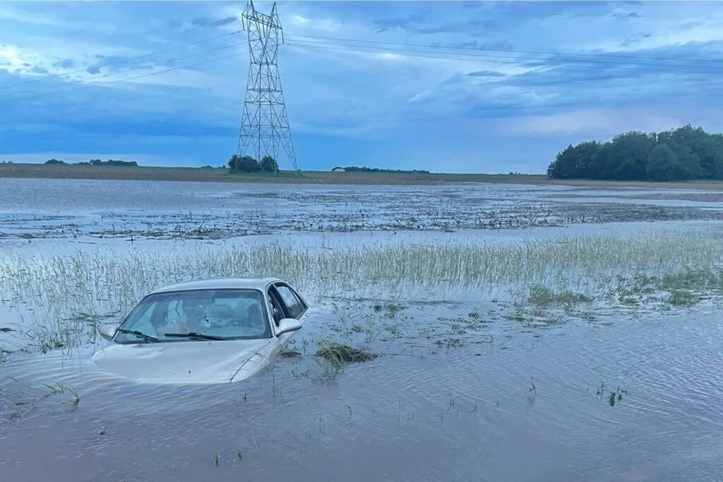
A car is partially submerged in a flooded area of Lincoln County on June 21, 2024. (Courtesy of Lincoln County Sheriff's Office)
Sioux Falls is asking area residents to limit their contributions to the wastewater system, while state officials are warning of river crests that will arrive Monday and Tuesday as southeast South Dakota recovers from several days of historic rainfall totaling more than 17 inches in some locations.
Mayor Paul TenHaken said Sioux Falls is diverting wastewater into holding facilities that have never been used before, and those facilities are full.
“This is the most strained the system has ever been,” he said.
He asked people in the Sioux Falls area to temporarily avoid doing laundry, taking showers, running their dishwasher or doing anything else that would contribute unnecessary wastewater to the system.
TenHaken participated in a media teleconference Saturday morning with Gov. Kristi Noem and other officials.
Noem encouraged everyone affected by flooding to document their property damages and relay that information to their insurance agent and their county emergency management director. She said the state will collect that information and apply it toward the $1.6 million statewide damage threshold needed to unlock assistance from the Federal Emergency Management Agency.
This is the most strained the system has ever been.
– Sioux Falls Mayor Paul TenHaken, while asking residents to avoid unnecessary contributions to the city wastewater system
The governor said rainfall totals since Thursday include 18.2 inches in Canton (Noem said that figure twice, and her spokesman confirmed the figure to South Dakota Searchlight afterward), 7.48 inches in Mitchell, 7.3 inches in Sioux Falls and 7.15 inches in Chamberlain. She said 21 of the state’s 66 counties are experiencing flooding.
“We have seen a tremendous amount of rainfall,” Noem said.
There are widespread reports of flooded roads and basements, but officials on the call said they have not received any reports of deaths, while reported injuries have been minor.
TenHaken said Sioux Falls emergency responders rescued six people during the prior 24 hours, including one man in the Big Sioux River near the falls. TenHaken said that man is lucky to be alive.
People may want to view the water roaring over the falls, TenHaken said, but they should stay away and view it through webcam feeds on the internet.
“Just maybe avoid going to the falls, would be appreciated,” TenHaken said. “It’s not really a safe place right now.”
Noem warned against complacency as the rainfall ends.
“All of that water is moving through our system and moving through our tributaries, our streams, our rivers and our dams,” she said, “and we are expecting high water flows to come downstream.”
Officials said several rivers are expected to crest Monday or Tuesday, including the James River near Yankton at 25.1 feet, the Big Sioux River near Sioux City at 38.4 feet, and a portion of the Vermillion River at around 30 feet. The Big Sioux figure would be a record for that segment, Noem said.

Those are all tributaries of the Missouri River, which is managed with dams. The U.S. Army Corps of Engineers said Friday that rainfall in eastern South Dakota, northeastern Nebraska and northwestern Iowa was 600% of normal during the prior 24 hours. The corps responded by lowering releases at Fort Randall and Gavins Point dams. The lower releases, continuing through Sunday, are expected to raise the water level behind Gavins Point by 2 feet.
John Remus is the chief of the corps’ Missouri River Basin Water Management Division.
“While the decreased releases are expected to bring lower downstream river stages, they cannot offset all the flooding in the Sioux City area,” Remus said in a Friday news release.
South Dakota’s secretary of public safety, Bob Perry, said a portion of Interstate 29 south of the Canton exit remains closed due to water over the road. He said an alternate route that had been established through Iowa “seems also closed at this point.”
Perry urged drivers to visit https://sd511.org or download the SD511 mobile app to view all current road closures, no-travel advisories and highway obstructions. Further information about South Dakota flooded roads is available at https://dot.sd.gov/travelers/travelers/flooding-information, and information about roads in Iowa and Minnesota is available at https://www.511ia.org/ and https://511mn.org/.
The National Weather Service forecast for southeast South Dakota includes scattered showers and storms through early Saturday afternoon with less than a quarter-inch of new rain in most areas. The forecast for Sunday is mostly dry with a chance of isolated showers and storms, and there are more widespread rainfall chances Monday night into Tuesday.
EDITOR’S NOTE: Since its initial publication, this story has been updated with additional information about rainfall totals from the National Weather Service.
GET THE MORNING HEADLINES DELIVERED TO YOUR INBOX SUPPORT NEWS YOU TRUST.
The post Strained wastewater systems, swollen rivers remain threats in flooded southeast SD appeared first on South Dakota Searchlight.

