Summer-like weekend with afternoon storms
TAMPA, Fla. (WFLA) — A hot and humid weekend is in store for the first full weekend of summer. Showers and thunderstorms are likely on both days as well, but mainly in the afternoon.
Feels like temperatures will be between 100 and 110 degrees before the storms develop so drink plenty of water this weekend.
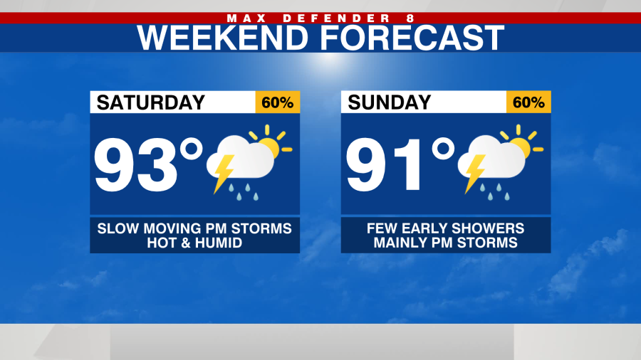
Storms will start to bubble up in the early afternoon hours along the coast. Watch for any early storms if you’re headed to the beach. Storms will increase in coverage through the late afternoon hours before slowly moving toward the coast this evening. Localized areas of flooding are possible where storms set up.

Sunday will also start out mainly dry with increasing rain chances through the afternoon and evening.
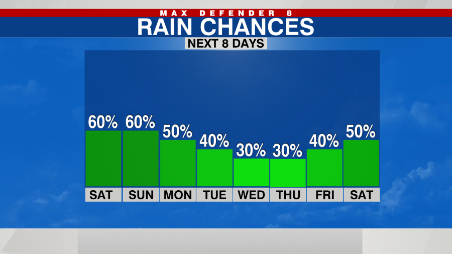
Generally, rain chances will decrease through the upcoming week as the coverage of showers and storms comes down with a pattern change. A few morning showers are possible with an onshore wind developing that moves showers and storms to the east coast in the evening.
The tropics are still active. The area of low pressure off Florida’s northeast coast has dropped to a near 0% chance of developing. It will have very little impact on our weather this weekend.
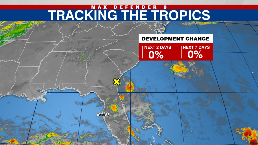
The area in the western Gulf of Mexico has a medium chance of developing through the next several days but will also have very little impact on our weather.

Thanks for signing up!
Watch for us in your inbox.
Subscribe Now
Daily Weather Forecast
Copyright 2024 Nexstar Media, Inc. All rights reserved. This material may not be published, broadcast, rewritten, or redistributed.
For the latest news, weather, sports, and streaming video, head to WFLA.

