Tracking the Tropics: When will the 1st tropical storm of the season emerge?
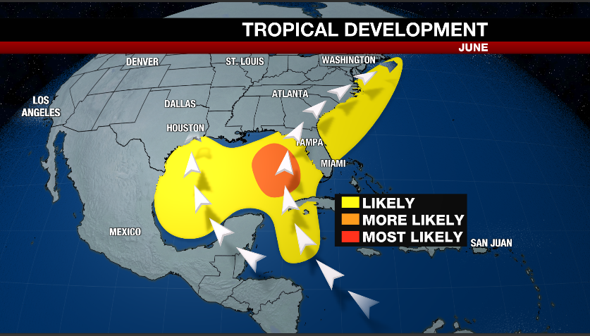
TAMPA, Fla. (WFLA) — During June, the main zones where we can see tropical development are the western Gulf, the western Caribbean, as well as near the Bahamas.
The main reason storms are more likely to form in these areas is due to the the extra warm water temperatures compared to the rest of the Atlantic Ocean.
Currently, the National Hurricane Center is tracking two disturbances that could produce some tropical weather.
Potential Tropical Cyclone 1
There are two areas we are watching in the tropics. The first is potential tropical cyclone one.
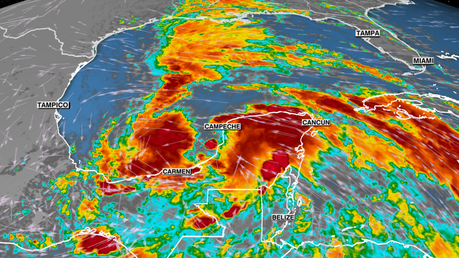
This system is a broad area of low pressure located in the Bay of Campeche and is producing maximum sustained winds of 40 mph.
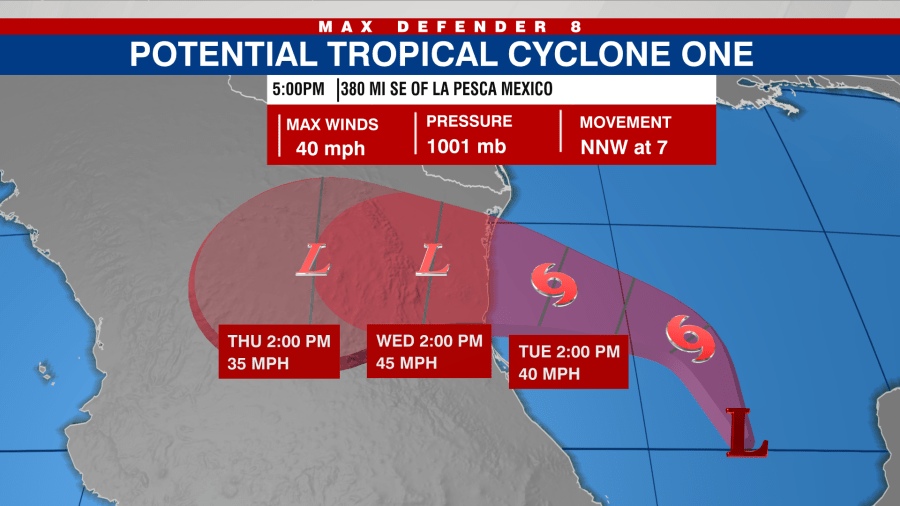
There is no well-defined center of circulation as of yet so this won’t be called a tropical storm until the circulation becomes well defined.
Once that happens, it will be named Tropical Storm Alberto. This system is expected to move northwestward and eventually to the west into eastern Mexico making landfall as a tropical storm overnight Tuesday into early Wednesday then quickly weakening as it moves over land.
As of this report, a tropical storm warning has been issued for “the Texas coast from Port O’Connor southward to the mouth of the Rio Grande” and “the northeastern coast of Mexico south of the mouth of the Rio Grande to Puerto de Altamira,” according to the NHC.

Several inches of rain can be expected in Mexico and even extreme southern Texas over the next couple of days.
A Disturbance in the Atlantic
The other disturbance we are watching is an upper level low pressure located several hundred miles to the east of the Bahamas.
Right now we are only seeing disorganized showers and thunderstorms with a low probability of development over the next few days.
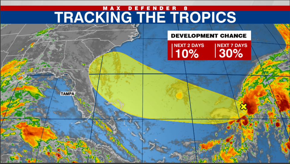
This system will continue to move west then northwest toward the southeast coast. At most, we will see a surge in moisture from this Late Thursday into this weekend.
Watch Tracking the Tropics on Tuesdays at 12:30 p.m. ET/11:30 a.m. CT.
Be prepared with the 2024 Hurricane Guide and stay ahead of tropical development with the Tracking the Tropics newsletter.
Copyright 2024 Nexstar Media, Inc. All rights reserved. This material may not be published, broadcast, rewritten, or redistributed.
For the latest news, weather, sports, and streaming video, head to WFLA.

