Two tropical storms looming in the Atlantic. What do they mean for Beaufort County?
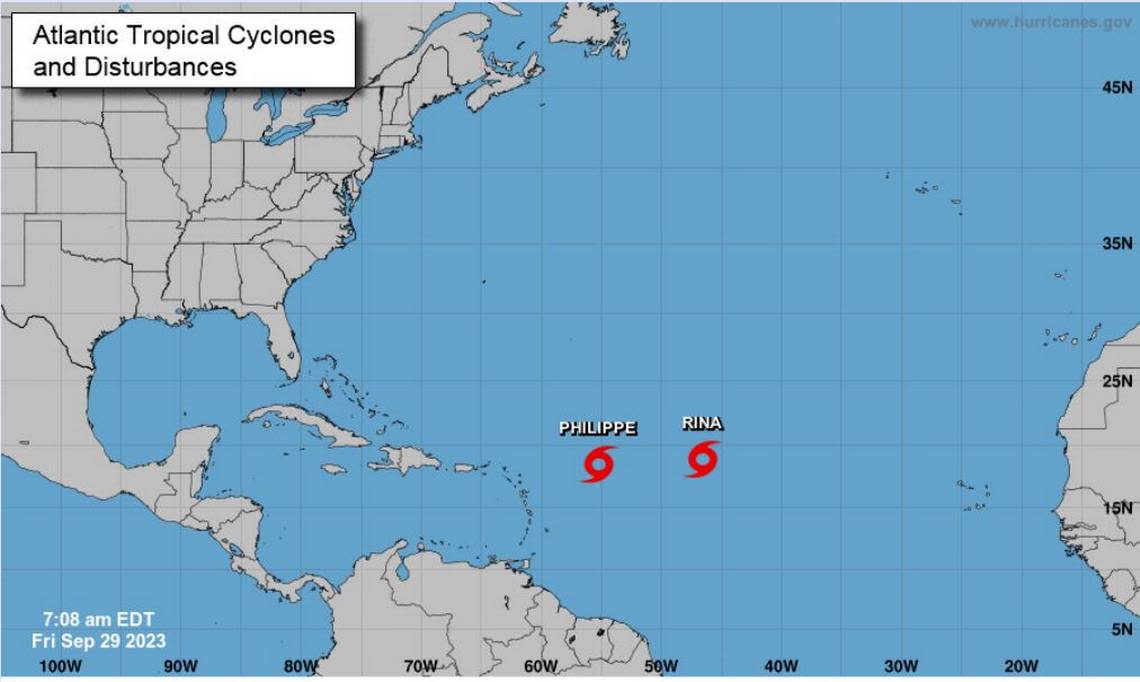
Two tropical storms, Rina and Philippe, both swirling in the Atlantic, are of no imminent concern to the Lowcountry’s coast this weekend, according to local weather officials.
“They’re basically dancing around each other out there in the central tropical Atlantic, but thankfully no direct threat to our area,” said Charleston Meteorologist Steve Taylor during a Friday morning briefing.
On Friday, Philippe was creeping at a near 2 mph toward the southwest about 520 miles east of the northern Leeward Islands. The island group includes the U.S. Virgin Islands, the British Virgin Islands, Anguilla, Saint Martin, Saint-Barthelemy, Saba, Sint Eustatius, Saint Kitts, Nevis, Barbuda, Antiqua, Redonda, Montserrat and Guadeloupe.
Philippe was packing winds of about 45 mph. Forecasters with the National Hurricane Center said “little change in strength” was expected “during the next day or so,” however, “some strengthening is possible over the weekend.”
“Philippe is about as disheveled as a tropical cyclone can be while staying a tropical cyclone,” said Frank Strait, a South Carolina severe weather liaison. “It likely wanders generally southwestward over the next few days. Hard to say at this point if it ever will play a direct role in our weather. We’ll keep an eye on it.”
Tropical Storm Rina slightly strengthened Friday morning, forecasters with the center noted. The storm was over 1,000 miles east of the northern Leeward Islands, with winds gusting up to 45 mph and north-northwest motion near 6 mph. Like Philippe, forecasters expected “little change in strength” in the storm in the coming days. But, unlike Philippe, Rina is predicted to weaken by early next week.
“Rina’s forecast track from NHC takes it toward Bermuda but keeps it weak,” Strait wrote on X, formerly known as Twitter. “It would have to be stronger than forecast to bring us coastal impacts.”
Strait said Friday’s models were “not as excited about a homegrown storm forming” this coming week. However, he still said to keep an eye on Rina and Philippe.
“Hopefully it turns out to be just a ghost sighting,” Strait wrote with his signature wit.
On Friday, the National Weather Service placed Beaufort County under a hazardous weather outlook, which warned of a high risk for rip currents until 8 p.m. and coastal flooding.
Elevated tides will continue to create the potential for coastal flooding along the South Carolina coast into early next week, the service said. Coastal flood advisories may be needed for the evening high tide, it added. Friday night’s high tide was predicted to reach 8.9 feet at about 10 p.m., according to US Harbors.
What’s the weekend forecast?
The National Weather Service boasted sunny skies and mid-80s temperatures for Beaufort County.
“This wedge of high pressure is going to continue and keep conditions really quiet and dry,” Taylor said. “Precipitation for the next seven days is non-existent. So we’ve definitely transitioned into a fall-like pattern.”
Saturday: Mostly sunny, with a high near 84. Low around 65.
Sunday: Sunny, with a high near 81. Low around 63.

